ACTIVITIES

THINGS TO DO IN THE PILBARA AREA

Here we have put together some suggested itineraries that you may like to take advantage of while you are in the area.


North West Shelf Project Visitor Centre

 View Map

Travel Time: 26 min
Distance: 28 km

The North West Shelf Project is a joint venture between six major international companies. It is one of the world’s largest liquefied natural gas (LNG) producers, supplying oil and gas to Australian and international markets from huge offshore gas and condensate fields in the Carnarvon Basin off the north-west coast of Australia.

The North West Shelf Project facilities include the Karratha Gas Plant, one of the most advanced, integrated gas production systems in the world, where LNG, domestic gas, condensate and LPG is produced. The Karratha Gas Plant facilities include five LNG processing trains, two domestic gas trains, six condensate stabilisation units, three LPG fractionation units as well as storage and loading facilities for LNG, LPG and condensate. The facility is located 1260 kilometres north of Perth, Western Australia and covers about 200 hectares.

The Karratha Gas Plant has an annual LNG export capacity of 16.9 mtpa which is reliably exported to customers in the Asia Pacific region and beyond. Woodside operates these facilities on behalf of the North West Shelf Project participants.

The internationally renowned North West Shelf Venture Visitors’ Centre includes interactive displays that invite you to look, touch, feel and listen as you learn. Overlooking the Karratha Gas Plant, the visitors centre is situated on the Burrup Peninsula Road about 20km from Karratha.

Admission is free, however opening times are seasonal so please telephone for information. P: +61 8 9158 8292

Sam's Island

 View Map

Travel Time: 22 min
Distance: 23 km

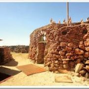
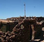
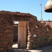
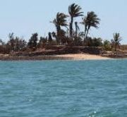
Just off the foreshore of Dampier sits Sam’s Island, a unique and fascinating piece of history dating back to the 1960s. It was originally named Tidepole Island in 1884, when the British Admiralty were undertaking data collection and hydrographic surveys. Poles were placed near the island to enable the measurement of the tides – hence the name Tidepole Island. When the iron ore industry arrived in the Pilbara in the 1960s a mining lease was granted for the island however this never took place.

History of Sam’s Island

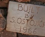
After surviving the horrors of World War II in Yugoslavia, Sam Ostojich arrived in Australia in 1960 and settled in the Pilbara in 1965, where he worked on the first causeway of the Karratha to Dampier Road. Sam’s first visit to Tidepole Island was aboard a raft lashed together with 44 gallon drums.

After becoming aware of the island Sam began building in 1966, using local and imported materials. The elaborate efforts were locally recognised. Rio Tinto provided a 99-year lease to Sam and connected the island to Dampier water supply. Sam died in 2005 and is buried on his island. Today tourists visit the island and tour operators and community members maintain the buildings and grounds.

Sam’s Island is a distinctive and attractive location close to Dampier. It is a physical reminder of the early era of modern Pilbara mining, migration and the colourful personalities that characterised that time, and is a rare type of site of human expression at the level of a whole island. Sam’s Island reminds us of the human creative spirit and provides an insight into the social histories of the 1960s.

A Modern Day Treasure

The City of Karratha and Sam’s Island Preservation Group in Dampier aim to preserve the island’s history, while keeping it natural and retrospective to the man who became a local icon.


For tours of the island contact Discovery Cruising 0408 801 040 or email: info@discoverycruising.com.au


Yaburara Heritage Trail

 View Map

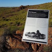
Yaburara Heritage Trail                                                                          The Yaburara Heritage Trail map downlaod

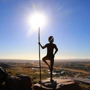
Heritage sites are very significant to Aboriginal people; they are of great interest to non-Aboriginal people and they are protected
by law. The layout of this trail was done in close liaison with the Ngarluma people, the Traditional Owners of the land. We trust
that giving people a better understanding will engender greater respect for Aboriginal culture.

Indigenous Habitation

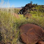
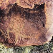
Sites identified along the trail indicate that these hills were inhabited on either a permanent or seasonal basis by Aboriginalpeople. Sites include engravings, stone quarries, artefact scatters,a Thalu site, shell midden with grinding material, and an area of grinding patches and basal grinding stones. The engravings consist of a wide range of motifs and styles, and involve a number of different engraving techniques.

Natural Environment

The Karratha Hills are an isolated range of steep sided low hills composed largely of metamorphosed (physically and chemically altered) igneous rocks, originally part of a volcanic complex.These rocks, some 2,700 million years old, were intruded by dykes of dolerites (ridges of coarse, dark igneous rock produced by the cooling of volcanic/semi molten material) about 2,200 million years ago. Some cherts (flint-like forms of quartz) and metamorphosed quartz rock sediments form the low ridges to the south and west of the main range of hills. The surrounding plains are largely underlain by granites with varying depths of recent river and coastal marine sediments.

The hills are an erosion resistant remnant shaped by an extensive system of joints and faults, the relative resistance to erosion of the individual rock types, and depositional features, especially on the lower flanks and small valleys. The dolerite dykes and quartz and pegmatite veins (coarse crystalline types of granite) are more resistant to erosion than the altered volcanic rocks and stand out as ridges and knolls.

Some of the more striking examples are the dolerite dyke near Galbraith Road and the one separating Karratha College and the Hospital. Because of their smaller size, the quartz veins and pods tend to form discrete knolls or humps on the slopes except in the lower hills to the south and west where low angular ridges are found.

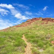
Allow yourself 1.5 to 3hrs to complete the walk, take enough water, sunscreen, hat and a mobile telephone.

The Yaburara Heritage Trail map is available to down load here


HEARSON'S COVE

 View Map

Travel Time: 26 min
Distance: 28km 

Hearson's Cove is a highlight attraction of the Burrup Peninsula. The tidal flats are home to plenty of marine life such as octopus, turtles, sea birds and crabs.

This lovely sheltered cove is a popular swimming and picnic spot all year round. It is one of the only locations where you can view the spectacular Staircase to the Moon event, which occurs from May through to October. The Staircase to the Moon, only occurs in WA and is a phenomenon that occurs when the full moon rises over the exposed mudflats at an extremely low tide, creating the optical illusion of a staircase reaching to the moon.

This picturesque shell beach boasts amenities such as barbeques, shade shelters and toilets and is conveniently accessible by 2WD on a sealed road. The area is also a fishing paradise for both amateurs and professionals alike with a huge variety of fish species inhabiting the area, including the much sought after Coral Trout, Red Emperor, Scarlet Sea Perch, Spangled Emperor and Norwest Snapper.

As always check your local tide and weather conditions before heading to Hearson’s Cove and don’t forget your sun hat, drinking water and sunscreen. This area has mobile telephone coverage.


STAIRCASE TO THE MOON

Travel Time: 26 min
Distance: 28 km

Located at Hearson's Cove - Staircase to the Moon is a natural phenomenon that occurs in northern WA.

You can witness this spectacular attraction during the time of the full moon at various points along the coast between Onslow and Broome. If you are in the Pilbara region at the right time, it is a sight not to be missed.

An optical illusion on the water creates the impression of a staircase leading to the Moon.

View the dates and times here supplied by Karratha Visitor Centre.


MURUJUGA NATIONAL PARK

 View Map

Travel Time: 26 min
Distance: 28 km

 Murujuga is the 100th National Park declared in Western Australia and has great historical significance.

The traditional custodians of the land are the Ngarluma-Yindjibarndi, the Yaburara-Mardudhunera and the Woon-goo-tt-oo.

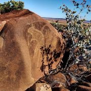
It is estimated that there are in excess of one million petroglyphs within the park itself. The rock art not only tells the story of human habitation, dating back to when the land was some 100 kilometres inland from the sea, but it also records the lore for Aboriginal people to the north western tip of Australia, south past Carnarvon and east as far as Alice Springs. Therefore the rock art has deep meaning for the local Aboriginal people. The park’s extensive rock art and associated archaeological materials include shell middens, stone artifact scatters, quarries, stone arrangements, ceremonial and mythological sites, graves and petroglyphs.

Located at the western edge of the Pilbara, the park is ecologically and biologically diverse. Major landforms and habitats within the park include steep scree-strewn granophyres and gabbro hills, narrow valleys, sandy and rocky shores, mangroves, mudflats and sea cliffs. Over 14 native ground mammal species, at least 14 species of bats, 58 reptile and two frog species are recorded from the area. Notable species include the Pilbara olive python, Rothschild’s rock wallaby and a number of shorebirds protected under international agreements.

Getting There
Leave the Dampier Road and turn onto the Burrup Peninsula Road. The national park is located on the right hand side of the road and includes the hills surrounding Hearson Cove. Hearson Cove itself is not a part of the national park. Continue along the Burrup Peninsula Road. Turn right onto the road to Withnell Bay. The national park lies north and east of Withnell Bay. From Withnell Bay onward the track is rough and suitable for walking, mountain bikes or high-clearance four wheel drives only. Stay on existing tracks.


JARMAN ISLAND LIGHTHOUSE

 View Map

Jarman Island Lighthouse is one of the Pilbara region’s most significant historic landmarks.

The lighthouse is located near Cossack and began operating in 1888 until it was decommissioned in 1985.

Since then it has been restored to its former glory. If you visit the Lighthouse you will also be able to see the remains of the quarters where the lighthouse keeper lived along with other historical artefacts of the time.  You can access the lighthouse on Jarman Island by boat.


Fishing

Dampier Archipelago

With some of the best shore based fishing opportunities in the country, the coastline around Karratha, from Point Samson in the east to 40 Mile Beach in the west, makes this a very exciting place to throw in a line from the rocks or beach.

Tides can be very important when it comes to fish activity, the low to high tide movement in the Karratha region varies from tide cycle to tide cycle with over a 4m movement on a ‘spring’ tide to less than 1m on a ‘neap’ tide. Neap tides occur on the first and third quarters of the moons cycle resulting in very little water movement.

The incoming and outgoing tides draw in small fish and other food to and from the shore, making for some hectic fun on a tide change at a few local spots. This can either be a high or low tide change around the area, including the easterly point of 40 Mile Beach and a few spots near Point Samson.

Poppers on a still day at high tide change will usually stir up a feeding frenzy of Queen fish, often referred to as the poor mans Barramundi for their aerial antics and attempts to throw a hook. A great deal of fun to catch on light gear!

Bait choice is often the most critical decision you will make and depending on which species you are targeting will determine what sort of bait you will need. As a rule in my experience, if you have a few squid and a frozen Mullet or two, you are in with a good chance of hooking up something decent. Mullies on a treble gang work well for Mackerel, Queenies and Trevally – simply cast out unweighted and slowly retrieve, vary the retrieval and gig the rod tip a little to give the Mullie a more lifelike swim quality and hold on tight!! Squid and strip baits work well for the bottom feeders like Spangled Emperor and Estuary Cod, with even a few decent Coral Trout being caught using a chunk of Mullet.

Lures of all sorts, shapes and sizes are often successful if worked well through the water, a simple steel slice will often work as well as a more expensive diving type lure if worked hard. Some people prefer a soft plastic and although I have had little success with these over the years off the shore, they certainly work in deeper water off a boat.

Discovery Cruising are your fishing experts, fishing charters  from $225 per person

Whether new to fishing or experienced, this charter offers an opportunity to spend time out in the beautiful Archipelago. Dampier Archipelago is one of the best fishing locations on the West Coast with open water or 42 islands to work around.

Game fishing, mackerel, coral trout, blue bone many more species to take home and enjoy. Depart Hampton Harbour at 9am or a time your group prefer (7 hours of fishing)– all fishing gear and bait is supplied. Group/individual bookings are available. Please note: Limits apply – minimum 8 persons maximum of 10 persons per charter.

Light lunch provided

What to Bring:

  • Sunscreen/hats
  • Lunch
  • Camera
  • Drinks (some alcohol 

Call them on:  0408801040  or email info@discoverycruising.com.au

Discovery Cruising Facebook page click here


ROEBOURNE OLD GAOL & MUSEUM

 View Map

Travel Time: 30 min
Distance: 37 km

The Old Roebourne Gaol is today home to a Museum, the Roebourne Visitors Centre and the Roebourne Arts and Crafts Group.

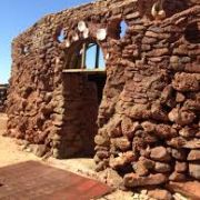
In 1884 the Roebourne lock up was proclaimed a Gaol. In 1887 it was decided that the original small wooden cells were dangerous and they were replaced by four new stone cells. These cells featured an iron ring in the centre of the floor so prisoners could be manacled for extra security. The ruins of the original stone cells can be viewed at the rear of the complex.

In 1896 the present building was constructed. It was designed in the decorative mode of the 1890s in the style associated with George Temple Poole.

Building plans show that the cells were denominated by the skin colour of the expected prisoner population. The larger four cells, radiating from an octagonal courtyard were for Aboriginal prisoners, with separate cells for European, Asian and female prisoners.

In 1924 the Gaol was closed due to the demise of the Cossack port and the subsequent decline in the population of the Roebourne area. The Gaol was refurbished and reopened as a prison in 1975 and operated until 1984, when prisoners were transferred to the new Roebourne Regional Prison.

As you wander through the complex take your time to reflect on the prisoners who lived within these walls. In the Museum you will gain a glimpse of what life was like for Aboriginal Australians after white settlement, as well as an insight into the experiences of European and Asian settlers to the region.

Wing 1
The Visitors Wing is set up with tea and coffee facilities, tourist pamphlets, seating and photographs and video of the Pilbara region.

Wing 2 Museum
Colonial History – photographs, artifacts and stories of the first station owners, miners and Roebourne residents.

Wing 3 Museum
Hidden Histories – discover a pictorial history of Aboriginal people in the Pilbara since white settlement, as well as a display on the experiences of indigenous and non-indigenous women in the region.

Wing 4
Roebourne Visitors Centre – friendly staff will assist you with information, tour bookings and directions.  A wide selection of books and maps are available for purchase, as well as souvenirs, cool drinks and snacks. A gold coin donation will give you entry to the Museum.

Rear Courtyard – contains a display of farming and mining equipment used in the early days and a display of Pilbara rocks and gemstones.

Ph: 08 9182 1060   Email: info@roebourne.org.au     


Pilbara Tour Co. run tours of the Goal during the winter months. https://www.pilbaratourco.com/


HARDING DAM

 View Map

Travel Time: 60 min
Distance: 66 km

The Harding Dam commenced early in 1983 and was completed for the 1984/85 wet season. It is located on the Harding River, 23 kilometres south of Roebourne.  The river takes its name from the explorer J Harding, a member of the 1861 north western expedition of F.T Gregory.

The Harding Dam was built to augment water supplies for towns and industry in the West Pilbara. However, due to the erratic nature of Pilbara rivers and high evaporation rates, and independent surface water storage cannot produce a reliable water supply. To overcome this problem the Harding Dam will be operated conjunctively with the Millstream aquifer.

The Harding Dam offers a picturesque drive, and is an ideal destination for a day’s drive and picnic, with free BBQ facilities, amenities, playground and gazebos, set among grassed areas on the edge of the downstream water. Enjoy a walk on the wall as well as a couple of lookouts.

Directions

From Karratha, take the North West Coastal Highway towards Roebourne
At Roebourne, turn right onto the Harding Dam access road and follow the signs for approximately 29km
The public access road to Harding Dam is via Roebourne. Please do not use the maintenance track as it is not regularly maintained and is for authorised access only.


COSSACK ART AWARDS

 View Map

Travel Time: 33 min
Distance: 48 km 

From humble beginnings in Western Australia’s resources heartland, the Cossack Art Awards have grown in size and stature over the years to become the richest acquisitive art award in regional Australia.

The Awards continue to grow both within the region as the highlight of the cultural calendar but also across Australia as a nationally significant art prize that attracts a high calibre of participation industry-wide.

Set amid the historic buildings of a heritage listed ghost town, the Cossack Art Awards attracts thousand of people every year to the small town of Cossack, some 1,600 kilometres north of Perth.

For three weeks across July and August Cossack comes alive with hundreds of vibrant artworks representing the very best artistic talent across the Pilbara region and Australia.


MTB- Mountain Bike Riding Karratha

 Video - Riding Karratha Hills

Travel Time: 2 min
Distance: 2 km

The town of Karratha is perfectly set up for mountain biking. It’s laid out in a long stretched-out rectangle, with the trails in the hills that rise next to the long side of the rectangle. So, no matter where you are in town, it’s always a very quick roll out to the trails.

Because of this, there’s no central trailhead, although the car park at the BMX club serves as good a meeting point as any. The trails are contained by main roads on four sides, making the risk of riding off Burke and Wills style into the outback impossible. 

Contact our local MTB club, Burrup MTB


MILLSTREAM CHICHESTER NATIONAL PARK

 View Map

Travel Time: 1h 50min
Distance: 123km

Millstream Chichester National Park is a comfortable 2 hour (150) drive from The Ranges Karratha.
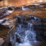
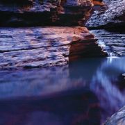
The sealed bitumen route along the Karratha-Tom Price road takes you through the precincts of the 200,000 hectare park, which surrounds the Fortescue River. The park presents a range of activities and scenery from deep gorges, to visit permanent pools nestled amongst brilliant white snappy gums and the deep red rocks that date back 1 billion years.

There are a number of interesting sites to visit within the park such as Deep Reach, which is a deep pool on the Fortescue River, ideal for swimming on hot summer days, or the Homestead Visitor Centre where you can enjoy a BBQ using the available facilities nestled among the shady grassed areas. 
Why not take a walk along one of the many walk trails that provide spectacular vistas and opportunities to capture some amazing photographs and experience the peace and tranquility along the way. For those looking for more of a challenge there are trails with varying levels of difficulty. 
There are over 120 species of birds, 30 species of mammals, 150 species of reptiles and 500 species of plants to be found in the park.

The Homestead Visitor Centre 
Some of the other activities available for visitors are kayaking and canoeing, fishing, horse riding, mountain biking, rock climbing and swimming.
If you have access to a 4WD vehicle, you will be able to access areas within the park not available to normal vehicles.
Regardless of the time of year you visit the park, there is always an abundance of wild life and changing landscapes on offer.


KARIJINI NATIONAL PARK

 View Map

Travel Time: 5h 34min
Distance: 491km

If you don't mind driving then you'll love the drive out to the Karijini National Park. It's a five and a half hour drive which take you through some spectacular spinifex covered ranges.

The route takes you through the world famous mining town of Tom Price. This is a great place to take a break and obtain refreshments at one of the café's in town. Tom Price also has a major supermarket should you wish to top up supplies before heading in to the park.
The park itself covers 627,422 hectares and lies just north of the Tropic of Capricorn within the Hamersley Range.
Karijini presents an array of deep gorges formed over millions of years with crystal clear pools that you can safely swim in. They are all accessible with varying levels of difficulty from an easy walk to those who may be seeking a little more adventure.

The Outback restaurant offers a menu that is uniquely Australian with tempting delights guaranteed to please! Continental and cooked breakfasts are also available each morning. If you decide to stay you can obtain a packed picnic lunch or snack for you to take to the gorges with you. Coffee, tea, snacks and drinks are also available all day at the kiosk/gift shop.


Ngurin Bush Tucker Trail

 Ngurin Bush Tucker trail

The Ngurin Bush Tucker Trail is located in Roebourne, in the North West of Western Australia, situated 30 km east of Karratha.The Ngurin (Harding River) and all of the vegetation surrounding it holds great significance to the Ngarluma people, the traditional owners of this land.

With valuable information and learnings from Ngarluma Elders, David Walker, Pansy Hicks and Violet Samson, the Ngurin Bush Tucker Trail features interpretive signage depicting bush tucker, bush medicines and other artefacts used by Aboriginal people in their traditional way of life, with some still being used today.

This Grade 2 trail is a 2 km circuit commencing at Roe Street in the Roebourne townsite. 

Download the Ngurin Bush Tucker Trail Map (195kb PDF)

Download the Ngurin Bush Tucker Trail brochure (8mb PDF)


WARLU WAY

The Warlu Way                                                                     Download the Warlu Way brochure       Warlu Way Tourism Brochure 2017

The Warlu Way follows the path of the warlu, or Dreamtime sea serpent, as it traverses North West Australia and the Pilbara and Kimberley regions of Western Australia – ancient and sacred landscapes rich in natural beauty and enchanting Aboriginal stories. Your jourrney takes you back in time to the mystical Dreaming era when the warlu emerged from the sea and travelled through the pulsing red heart of the outback, forming magnificent waterways as he moved.

The Warlu Way Trail

Beginning on the shores of the world’s largest fringing reef, Ningaloo, the Warlu Way leads you 2,480 kilometres from sapphire seas to the lush oases, soaring gorges, rugged ranges and ancient Aboriginal art of North West Australia’s Pilbara and Kimberley regions. Interpretive signage along the drive opens your eyes to the secrets of this country and its historical, cultural and natural wonders. 

Welcome to Country

The Warlu Way is a magical insight into Indigenous relationships, responsibilities and respect. It opens your eyes to the Indigenous people’s relationship and connection to the land. It acknowledges the ongoing responsibility Indigenous people have to their country. And it shares respect for Aboriginal beliefs and cultures. As a visitor, please travel thoughtfully and respect the wishes of your hosts.

Start Planning

Click on the links to find out more about getting to North West Australia and travelling around the Kimberley and Pilbara regions of Western Australia. Be aware of road safety and health and safety issues.  Click to view the Warlu Way map and road trip itinerary.


EMMA WITHNELL TRAIL

 View Map

Travel Time: 32 min
Distance: 48 km

The Emma Withnell Heritage Trail, named after the first European woman settler in the North West, is a 52km self driving route which retraces the settlement and development of the Roebourne district.

The trail begins at Roebourne, once the ‘capital’ of the North West, and features: Cossack, the first port; Point Samson, established in the 1900s as a deep water port; and Wickham, an iron ore Mining town gazetted in 1971.

Featuring historical buildings and sites within the district, the trail offers a pleasant half day outing with opportunities for walking and pick-nicking. Follow the trail route map, look for signs bearing the Heritage Trails Network symbol.

Download Emma Withnell-Mother of the North West


Miaree Pool

 View Map

Travel Time: 20min
Distance: 20 km


Miaree Pool is only a 20 minute drive south from Karratha on the North West Coastal Highway. A lovely spot for swimming, Miaree Pool offers a picnic area, car parking and plenty of shady spots for relaxing on the river bank.

To get there, take the turn off located about 200 metres north of the Maitland River bridge. You will find the picturesque clear water pool just a few hundred metres east of the bridge.


Dampier

 View Map

Dampier is the gateway to the 42 Islands of the Dampier Archipelago in the North West of WA. Blessed with beautiful beaches and warm, sunny weather, this outback coastal town is a mecca for outdoor water activities. Swimming, sailing, boating, fishing, diving, snorkeling and wind surfing can be enjoyed here all year round.

Just 20 kilometres from Karratha,  this pretty port town overlooking Hampton Harbour and the Dampier Archipelago was named after the English buccaneer William Dampier – the first recorded European visitor to the area. It was established as a large tonnage shipping port in the 1960s by the mining company Hamersley Iron as the export location for iron ore mined from Tom Price and Paraburdoo.

Attractions

  • Visit Sam’s Castle on Tidepole Island, more commonly referred to as Sams Island. The island can be seen from the Dampier foreshore, contact Discovery Cruising for regular trips to the island.
  • Enjoy a guided tour through some of WA’s big mining and resource operations. Bookings for the Pilbara Resources Tour can be made by contacting the Karratha Visitor Centre. Take an up close look at Parker Point and East Intercourse Island, Rio Tinto’s Dampier based loading operations.
  • Explore the Burrup Peninsula and view the amazing ancient Aboriginal rock art.
  • Pay a visit to the Dampier Library to view the Japanese doll collection. The dolls were given to Pilbara Iron as gifts from Japan and China
  • Take a look at the enchanting Red Dog statue (The Pilbara Wanderer), located at the entrance to the town. The inspiration for the movie ‘Red Dog’! This famous kelpie was born in Paraburdoo in 1971, but spent most of his years travelling throughout the entire region, from Perth to Broome. He would hitch lifts in trucks or buses, however his exceptional homing instincts always returned him to Dampier or Karratha. 

Whim Creek

 Video of Whim Creek

Travel Time: 1hr 30 min
Distance: 127 km

Known by Pilbara locals as ‘The Creek’ the Whim Creek Hotel was once the centre of a thriving mining town. While the town has passed in to history, this iconic, historic inn is still at the heart of the Pilbara. And with traditional outback hospitality, a crowd pleasing menu of top quality pub favourites and a wide selection of drinks it’s not hard to see why. ‘The Creek’ offers a wide selection of accommodation options from free camping and caravan sites to single, ensuite ‘donger’ style rooms, double rooms and family rooms. Our swimming pool and BBQ area is popular with guests of all ages.

Map of Whim Creek locality.


CLEAVERVILLE

 Video-Cleaverville beach & estuary

Travel Time: 30 min
Distance: 30 km 

Cleaverville is a popular spot for camping or day trips just 20 minutes northwest of Karratha.  It features a number of ideal sites for camping and day trips, and great fishing spots off the beach and at the mouth of the Cleaverville Creek.


Wildflower trail

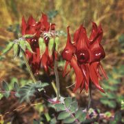
The Pilbara Wildflowers offer a dramatic contrast to our harsh red earth, ranging from blankets of purple Mulla Mulla, Sturt Desert Pea, yellow Wattles and orange Cockroach Bushes. For those following the wildflower trail, the best time to view our magnificent flora on the West Pilbara Coast is generally during the winter months from June to August.

Sturt Desert Pea is the most commonly identified of all the wildflowers on the West Pilbara Coast. The Desert Pea is named after the explorer Charles Sturt, who encountered vast drifts of them while exploring the central regions of South Australia, however the first specimen was actually collected from the Dampier Archipelago (East Lewis Island) by William Dampier in 1699. Four species of the Sturt Desert Peas have been photographed in this area; crimson with red bosses (the raised centres of the flower), crimson with black bosses, a white hybrid variety and a crimson and white variegated (which is less common).

Amongst the vast plains of red rock and hardy spinifex species, the Pilbara is home to a variety of tropical plant life found growing on the fringes of permanent freshwater pools. The Millstream Chichester National Park offers an abundance of tropical plant life ranging from the Millstream Palm (identifiable by its fanned, greyish-green leaves and smooth bark), to its introduced species from early pioneers such as the exotic Date and Cotton Palms found throughout the Millstream Delta.

The following itineraries provide a guide to exploring the Pilbara’a wildflowers:

Pilbara Trail  –  provided courtesy of Tourism Westerna Australia


Roebourne Heritage Trail

 View Map

The Roebourne Heritage Trail is a self-guided 5km walk or drive (with an extended option of 8km to visit three outer-town sites) capturing the most significant historical sites in Roebourne. The route is signposted with large interpretive signage detailing the importance and history of each building or site.

This trail takes you on a journey to discover the history behind eighteen of the oldest and most significant buildings and sites in Roebourne. The trails also provides an insight to how life was for the early settlers and Aboriginal people all those years ago.

Book Now
Best rates guaranteed